
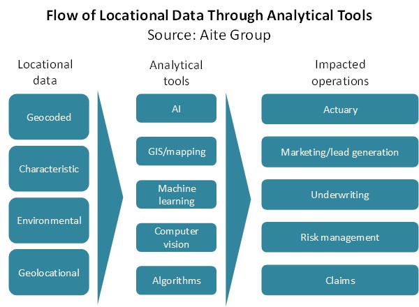
Boston, February 26, 2020 –Carriers are always searching for the silver bullet that will allow them to underwrite policies with more confidence, adjudicate claims without having to pay out one cent more than necessary, and prevent claims from ever having to be paid out. Locational data enables carriers to underwrite with more confidence, understand exactly what was damaged and where any forces that caused damage occurred, and identify locations where they’ve underwritten policies for assets that could be in danger. While it’s not that silver bullet, it comes close.
This report is intended for insurance executives interested in getting a better sense of what locational data can offer and a deeper understanding of what types of locational data solutions are available. Based on 25 interviews conducted with executives at P&C insurance carriers and locational data-oriented vendors in North America between June 2019 and January 2020, it profiles Betterview, Cape Analytics, Cognizant, CoreLogic, Delos, Digital Globe, DRN, EarthDefine, Environics Analytics, Geospatial Insight, HazardHub, Hover, Insurity, LexisNexis Risk Solutions, LightBox, Loveland Innovations, Syncsort, Tableau, Tnedicca, Truepic, and Verisk.
This 57-page Impact Report contains one figure and seven tables. Clients of Aite Group’s P&C Insurance service can download this report, the corresponding charts, and the Executive Impact Deck.
This report mentions Cincinnati, The Hartford, Menlo Venture, and State Farm.
About the Author